Call for Expert Advice
0800 453 422
Official NZ Leica Geosystems Dealer
Free Shipping For Online
Orders Over $50
RTC 360 RC Newsletter 1000 x 500

LEARN FROM THE LOCAL EXPERTS

Boost your knowledge as you learn from our expert Reality Capture team of qualified instructors with technical training courses designed to deliver professional development and key industry skills.

Indent Triangle 20x20 No background (2) REALITY CAPTURE TRAINING COURSES

Reality capture is a growing market and requires a high level of technical expertise. Join our expert instructors on one of these courses and take your knowledge to the next level.

Synopsis:

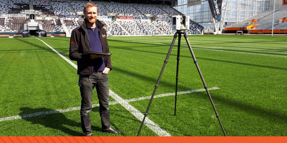
Get hands-on experience with the operation of 3D laser scanners and accompanying post-processing software solutions. From capturing data into the field right through to the creation of high-quality digital deliverables in the office, this course will provide beginners with best-practice techniques and workflows to ensure accurate and reliable deliverables are realized in the most efficient manner possible.


What you'll learn:

Planning a scan job

Operating a laser scanner in the field

Registering scans together

QA/QC of data

Geo-referencing of data

Generating suitable formats for downstream consumption.


Duration:

1 Day


Cost:

$1,500 (Including Scanner Hire)

Experience level:

Professionals with no prior laser scanning experience.

Enquire Now Button X130

Synopsis: 

Learn to use more advanced data management and registration techniques, which may be required to meet the more challenging project specifications, particularly on larger projects or when basic cloud-cloud registration falls short. 

What you'll learn:

Grouping data on large projects

Target based registration techniques

Using modelled objects as targets

Dealing with noise in cloud-cloud constraints

Estimating Registration Errors

Raising the accuracy of a registration

Advanced QA/QC procedures

Advanced Geo-referencing

Registration First-Aid 

Duration: 

1 Day

Cost:

$1,500 (Including Scanner Hire)

Experience level:

Users with previous laser scanning and registration experience looking for a deeper understanding of software workflows.


Enquire Button-1


Synopsis:

Get hands-on experience with the operation of quadcopter or fixed-wing UAV’s and Reality Capture software for creating rich, spatially accurate 3D digital deliverables that can be trusted.

What you'll learn:

Field

UAV flight planning

Image capture settings

Layout and measurement of ground control

Use of SmartFix for RTK UAV’s (cm level positioning)


Office

Image Processing & Reality Modelling

Use of Geoid files for orthographic heights (in terms of local height datum)

Integrating point clouds from laser scanners

Quality Assurance procedures

Generation of digital deliverables (point clouds, reality meshes, DSM’s, DTM’s, orthophotos, CAD files)

Duration:

 1 Day

Cost: 

$1,500

Experience level: 

Professionals looking to enter or extend their offering in the UAV industry with a focus on delivering spatial data that can be trusted.


Enquire Button-1


Synopsis:

Modern software allows for a wide range of rich deliverables to be derived from point cloud data. From simple cleaning and visualization of the raw point cloud right through to advanced 3D modelling and analysis, this course can be customized to suit the requirements and experience of the attendees.

What you'll learn:

Manual and semi-automatic point cloud cleaning

3D Meshing tools (including DSM/DTM creation

Mesh refinement and improvement

Inspection and measurement (including flatness, verticality)

Domain-centric workflows for AEC, Survey and Tank Inspection, such as Scan-to-Plan, Clash Analysis, Building Extractor, Cross Section Analysis and more

Feature extraction (including CAD deliverables)

Best fit modelling (patches, cylinders, pipe runs etc.)

Contour extraction

Stockpile Volume reporting

Reverse engineering

Report creation and customisation

Duration:

 0.5  - 2 Days

Cost:

$1,000 - $3,000

Experience level: 

Anyone from beginners to experts looking to extract valuable and actionable deliverables from point cloud data.


Enquire Button-1

Synopsis:

The role of the Surveyor is changing, along with the use cases of reality capture information. Clients are not always after high precision deliverables. This training courses offers insight into different ways reality capture data is being used with a focus on visualisation.

What you'll learn:

Dispelling myths (e.g. point and shoot, point clouds are all the same…)

The changing roles of surveyors (Surveyors as the data managers?)

Use cases of reality capture beyond Survey

VR for stakeholder engagement
Digital Twin solutions

Strategies for widening reality capture applications in your business.

Automation Is the future! Where is this all going?

Basics of reality capture methodologies; getting ready for the industry 4.0

Basics of reality capture deliverables

Duration:

 0.5 Day

Cost:

$1,000

Experience level: 

Professionals with no prior laser scanning experience. Digital technologies looking at expanding the use cases of reality capture across the business.


Enquire Button-1

Synopsis:

The world of Reality Capture software is always changing. It has recently been announced that the addition of new features to Leica Cyclone Core will be discontinued in 2023. New features will soon only be added to Cyclone Register 360. Leica’s aim is to make Leica Cyclone Register 360 a one stop shop for all point cloud processing needs. Considering this, migrating across may provide your business many benefits. This training allows the trainer to go through a workflow comparison and help you make the transition.

What you'll learn:

Review of your Cyclone Core Workflow Overview
Cyclone Register 360 - Leica Cyclone Core Workflow comparison
Cyclone Register 360 functionality
Cyclone Register 360 processing
Converting your Cyclone Core QAQC workflow to Cyclone Register 360

Duration:

1 Day

Cost:

$1,500

Experience level: 

Professionals proficient in Leica Cyclone Core wanting to transition to Register 360


Enquire Button-1

Indent Triangle 20x20 No background (2)CUSTOMISED TRAINING

  • Customised Survey Workflows

  • Customised Captivate Stylesheets

  • Customised Pointcloud Workflows

Talk to us about your training requirements and how we can tailor a course to fit your specific project or team.

Find Out More Button


Indent Triangle 20x20 No background (2)LEICA E-LEARNING

For product specific training, Leica E-Learning offers a comprehensive range of training courses and e-learning opportunities to all Leica customers. 

Find Out More Button


Indent Triangle 20x20 No background (2)LET'S TALK TRAINING

Enquire here for more information on our Reality Capture training courses.

Enquire Button-1


Indent Triangle 20x20 No background (2)TRAINING FEEDBACK

Lennon was extremely knowledgeable with the content of the training. Very through in answering all the questions fired at him, from a different range of backgrounds with respect to Drone and Laser Scanning."

“Kirsty was very helpful dealing with our client and helping them out with the deliverables.”

“The team was very impressed with the training and excited to learn the new software, the training was presented very well and it has encouraged the guys to take more time learning the software.

“Extremely interactive and informative.”


MEET THE INSTRUCTORS

Tap into decades of knowledge and technical expertise with our team of qualified industry experts.

Bruce-circle

Bruce Robinson

Director & Survey Manager

With more than 30 years experience as a Surveyor, Bruce's specialist areas of interest include geomatics, geodesy, HDS, BIM, IT, and communication technology to improve spatial data capture and analysis. Bruce has been instrumental in developing the SmartFix RTK network.

768px-LinkedIn_logo_initials

lennon-1

Lennon Bedford

Reality Capture Specialist

Lennon is a Technical Specialist and Christchurch Branch Manager at Global Survey. Lennon's  areas of expertise are in terrestrial and aerial data capture, hybrid processing of point cloud and imagery datasets and the refinement of work-flows for extracting value out of results.

768px-LinkedIn_logo_initials

Kristie Mckie

Kirsty Mackie

Reality Capture & Autonomous Survey BDM

Kirsty has experience planning, managing and capturing Reality Capture data on projects of varying scales. This has primarily been for high precision topographic survey, asset management (e.g. digital twins, GIS and BIM), and visualisation purposes.

 768px-LinkedIn_logo_initials