Take control of the process from data capture through to final design with a more efficient end-to-end workflow that delivers more for your clients. Leica Geosystems' leads the world with state-of-the-art reality capture solutions that enable you to create the most realistic digital designs.
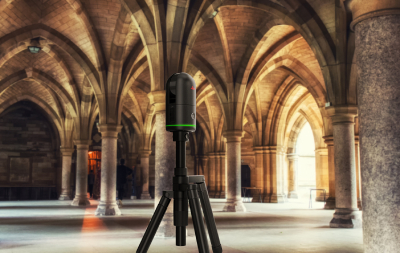
Precision, simplicity and affordability converge in Leica’s latest laser scanning release — the BLK360 SE!
Get started with 3D and 2D modelling right away using a complete Leica Geosystems bundle that combines three advanced tools for easy, efficient scanning and data capture.
Designed to provide fast, accurate and highly portable scanning capabilities, the Leica BLK360 SE is designed to enhance workflows in architecture, construction, engineering and beyond. When paired with PinPoint software, users unlock a streamlined, powerful solution for data processing, visualisation, and analysis.
Leica Geosystems leads the world in reality capture technology, with a broad range of terrestrial and mobile laser scanners that deliver outstanding speed and the highest quality 3D data, with exceptional ease of use. Leica laser scanners are the ideal solution for reality capture tasks.
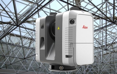
The Leica RTC360 is fast, agile and precise with a supercharged workflow. Capturing 2 million points per second and full HDR imagery in less than a minute, it's the fastest laser scanner on the market.
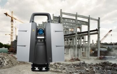
The Leica BLK2GO is a handheld mobile laser scanner that creates colourised 3D point cloud data while you walk through a space. It uses advanced GrandSLAM technology to match together different scenes as you walk, drastically reducing data post processing speeds.
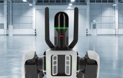
The Leica BLKARC is an autonomous laser scanning module for robots. It is designed to be integrated with robotic carriers to enable autonomous mobile laser scanning with minimal or no human intervention. Together, they deliver fully autonomous and repeatable scan missions to capture 3D point clouds and panoramic imagery.
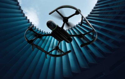
The Leica BLK2FLY is an autonomous flying laser scanner with advanced obstacle avoidance for easy reality capture from the sky. It captures building exteriors, structures, and environments to create 3D point clouds while flying.
Leica Cyclone REGISTER 360 is all about speed and simplicity, while maintaining scalability and robust point cloud QA/QC procedures
Cyclone REGISTER 360 empowers users of any skill level to work smarter, deliver results more accurately, visualize in more detail and collaborate more effectively – placing the user at the center of their project.
Drag, Drop, Done. From project creation to final reporting, project completion is significantly faster thanks to multithreaded batch routines, one-step import and processing, guided workflows, built-in QA/QC tools and automated reporting to save significant time and guess-work while delivering higher productivity.
Cyclone REGISTER 360 handles even the most challenging of projects with ease and takes the headache out of complex workflows. New users can execute large projects, scaling to your needs, thanks to the simple-yet-powerful interface.
Deliver professional-level project deliverables with ease. Cyclone REGISTER 360 provides guided registration workflows to assist new users and speed the process for experienced users. Intuitive QA tools and reporting take the guesswork out of your registration quality and put all the information you need at your fingertips. Batch export your final products to a range of formats and programs and even push live data to the cloud for global collaboration with the click of a button. Cyclone REGISTER 360 now supports publishing of Leica Geosystems universal digital reality file, the LGS file, for simple downstream use in TruView, JetStream and CloudWorx.
Capture ![]()
![]() Prepare
Prepare ![]()
![]() Manage
Manage ![]()
![]() Deliver
Deliver ![]()
![]()
Reality Cloud Studio is an easy-to-use reality capture cloud software solution to seamlessly connect people, projects, and reality capture data. Unleash the potential of your reality capture data and foster collaboration by sharing, visualising, and using digital reality data directly in the cloud.
Reality Cloud Studio features:
Reality Cloud Studio is agnostic. Users can upload data captured by any sensor if it can be provided in one of multiple industry-standard formats such as:
By leveraging the cloud and advanced technologies, Reality Cloud Studio is transforming how professionals work with reality capture data across various industries, including construction, architecture, engineering, and more.
Learn from the local experts - Boost your knowledge as you learn from our expert Reality Capture team of qualified instructors with technical training courses designed to deliver professional development and key industry skills.
.jpg)
The University of Otago is using the Leica BLK2GO to radically increase the accuracy and detail of information on 800-plus buildings that cover almost 222,000 square metres. "With a large portfolio of deferred maintenance and a limited budget to address that in the short term, applications such as this, provide improved data for better decision making and planning”
.jpg)
Context Architects are not your ordinary architecture firm, their 70-strong team of architects, urban, interiors/retail designers and remediation specialists are passionate about the power of good design to lift people’s lives. The Leica BLK2GO fits perfectly into their already well-established digital offering.
Read how Vitruvius utilised the Leica P40 Scanstation to capture highly accurate point cloud data of bridges, tunnel interiors, portals, and the rails themselves. With many assets nearing their ‘end of life’ and requiring replacement a spatial assessment of 13 tunnels and 6 bridges was required to determine their clearances and structural integrity.
.jpg?width=600&height=300&name=Maritime%20(600%20%C3%97%20300%20px).jpg)
Few structures are more complex or intricate than maritime vessels, so when our Christchurch team saw the historic Tug Lyttelton, they knew it was the perfect worthwhile community project to get involved in. "The speed of the RTC360 scanner gave us the luxury to capture more than enough overlapping data to create a comprehensive and robust registered point cloud. In this case we captured almost 1 billion points over 120 scans”


This group is a central place to unite with reality capture users in New Zealand. You might be a professional working in Surveying, Digital Construction, 3D scanning, BIM or a related field. No matter what your expertise level, ARCH NZ is a place where you can connect with other professionals and continue to learn and develop your skills.
By joining ARCH NZ, you'll gain access to:
Apply here if you're keen to join us:
Our specialist Reality Capture team work alongside our customers as technical partners, able to provide indepth advice and training on hardware, software and workflows. Reach out to them for help with any curly questions or challenges.