Every Surveyor is defined by how they overcome challenges. Having the latest technology at your fingertips speeds up the process at every stage, boosting productivity and delivering more for your clients. Leica Geosystems has a history spanning over 200 years of developing technology, designed by Surveyors for Surveyors.
Meet the Leica TS20 — the next-generation robotic total station built to be ready for any project.
With AI-driven automation, rugged reliability and unmatched workflow integration, it’s designed to raise the bar for productivity in the field. It’s not just built for today it’s built for what’s next.
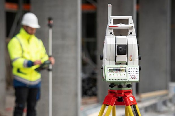
Scanning and in-field result delivery with the Leica Nova MS60 has been made simpler through the instant creation of point clouds, images and/or 3D models, and comparisons in one view.
Visualisations are clearer and easier to see on the 5” screen. The unique capabilities of the Leica Nova MultiStation truly deliver the new experience in measuring technology.
Leica GS18I GNSS
A versatile, survey-grade GNSS RTK tilt rover with visual positioning. Designed for surveying professionals to measure points which previously could not be measured with a GNSS rover easily and accurately. You can quickly capture the site in imagery and measure points from them, either in the field or later back in the office.
The Leica AP20 AutoPole is a unique and productivity-boosting smart system for Leica robotic total stations.
The AP20 AutoPole measures pole height, pole tilt and assigns a unique ID to your prism, removing the three most common sources of total station error.
Leica Infinity is a productivity powerhouse that connects field to office like never before. Leica Infinity enhances data communication, enables complex project collaboration, and speeds up post-processing by connecting Leica Geosystems services, CAD workflows, and even 3rd party services.
SmartFix
GNSS RTK Network Service
SmartFix is a subscription based service offering GNSS Network RTK corrections throughout New Zealand.
Smartfix delivers:
New users are welcome to try the SmartFix service for FREE for 30 days.
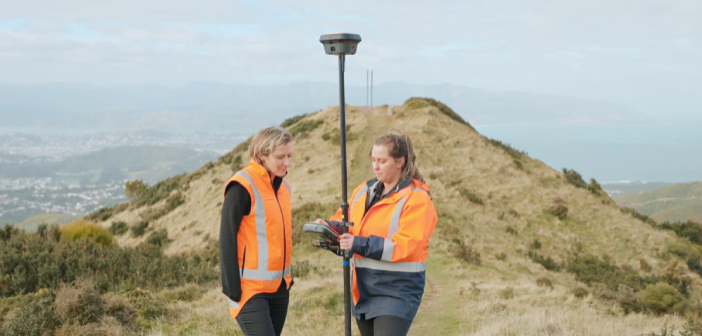
In our latest video, we caught up with the Envelope survey team, high up in the hills above Ōwhiro Bay in Wellington, as they work with Zipline Technologies to help deliver a project that will result in four ziplines and extensive walking tracks throughout the regenerated native bush.
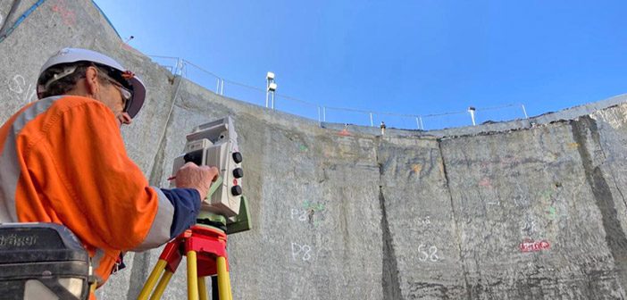
The Watercare Central Interceptor Project in Auckland has reached an exciting stage as the team prepare for the arrival of Hiwa-i-te-Rangi their giant new Tunnel Boring Machine [TBM] which is currently being built in Germany. The main contractor Ghella Abergeldie Joint Venture are building the Central Interceptor over six years with most of the construction work taking place underground. The 190m long TBM will be used to bore through the earth’s substrate and lay segments of the tunnel as it goes.
One of the most exciting and relevant new digital technologies is Augmented Reality (AR). AR offers gains across the construction industry with benefits for site safety, utilities design, visualisation and asset management across the civil and commercial sectors.
The Global Survey team recently ran two workshops for the final year students at University of Otago Survey School. From a practical perspective the plan was to demonstrate how the latest technologies are able to make graduates more productive and efficient for when they enter the work force at the end of their current year of study.
We're with you every step of the way
Our specialist Survey team work alongside our customers as technical partners, able to provide indepth advice and training. Reach out to them for help with any curly questions or technical challenges.

Bryan Claridge
North Island

North Island

South Island
We're here to answer all your Surveying questions, contact us to start the conversation.
![]()