.jpg)
Every monitoring project is different and unique. The range of monitoring solutions available from Global Survey combines versatility and flexibility in adapting to your project’s requirements, regardless of the environment or the object that requires monitoring.
Whether it is human activity or natural process, you can rely on the proven solutions from our world-leading technology providers to always provide the highest levels of safety, performance and sustainability.
Monitoring solutions are flexible and customisable to suit the requirements of your project. Some of the technology options include Total Station, Comms Box, GNSS, Radar or Tilt Sensors in combination or alone.
Our team have the experience and technical knowledge to help customise a practical and effective solution for your next monitoring project. Send us an enquiry to start a conversation with our specialist team.
Kurloo is a brilliantly simple displacement and settlement monitoring technology that autonomously monitors risk and supports better informed decisions.
This cost-effective solution combines reliable all-in-one Kurloo units installed at monitoring points to collect data remotely and the Kurloo Nest cloud-based processing platform for data visualisation and analysis.
The patented Kurloo device and Nest software platform uniquely combine Global Navigation Satellite Systems (GNSS) and the Internet of Things (IoT) to deliver precise and frequent positioning data.
The perfect total station for permanent and campaign monitoring projects.
The robust, precise and enduring Leica Nova TM60 helps with monitoring projects whenever you need to collect data securely and continuously. It comes with a firm promise: real-time information and reports you can always rely on, helping you make informed decisions in time and on time.
Be it settling, flexing, shifting, sliding or any other change of state – you will have it under control 24 hours a day, seven days a week. The TM60 comes with the world’s longest ATRplus range, half-second automatic aiming accuracy, advanced imaging and the longest continuous operation.
Designed with simplicity in mind, the ComBox60 only needs to be mounted in the field, have the sensors connected to it, and with the press of a button, is all set up and ready to start monitoring. Making customised and cumbersome communication boxes a thing of the past, the ComBox60 speeds up and simplifies the geodetic monitoring sensor setup in the field.
Even in the event of power and/or communication failure, the ComBox60 will continue to autonomously control monitoring sensors based on configured measurement cycles, intelligently adapting to environmental conditions and locally logging raw data. Data transmission resumes once communication is restored. In the case of a power outage, the ComBox60 will run on its internal battery.
GNSS monitoring is ideal for assets like dams, bridges, and landslide areas where rapid catastrophic failure is not expected but acknowledge of relatively small movement over months can provide valuable insights.
GNSS monitoring can be Real Time Kinematic (RTK) as a relative technique. RTK will give a 3D position of the monitoring point at a chosen rate. Real time monitoring at high speed is also a specialty of RTK as positional movements may be tracked at speeds up to 50 Hz.
GNSS monitoring can also be a Post Processed solution that uses more observations and gives a higher quality solution and more suited to tracking slow movements over time.
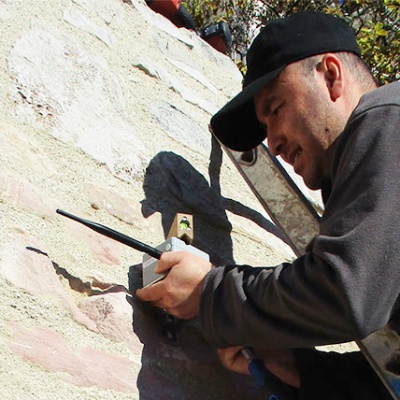
Offering wireless dynamic and autonomous data acquisition from geotechnical sensors using edge technology. Automated geotechnical sensor measurement, which utilises long range wireless radio nodes and a SmartGateway, allows you to focus on more challenging tasks instead of manual data acquisition and logging.
WiSen sensor nodes are transmitters and receivers that create a self-forming dynamic radio mesh network which sends data to a SmartGateway. Users have full, remote control over the system via direct, triggered, or scheduled changes enabling dynamic measurement and reporting rates from 1Hz to twice a week.
![]()
For monitoring professionals who need to quickly understand and react to complex demands of today’s monitoring projects, Leica GeoMoS is a solution that provides needed flexibility to their projects.
With scalable software, options and various licensing packages, Leica GeoMoS family adapts to specific needs of any user. Suitable for continuous or periodic projects, a complete monitoring solution is offered with the highest accuracy and reliability.
GeoMos can manage your data flows, automated reporting, alarming and complex adjustment.
HYDRA-G is a compact, remote sensing monitoring system designed for early warning and real-time measurements of sub-millimetric displacements in buildings, dams, tunnels, mining infrastructures, and cut-slopes.
HYDRA-G is able to provide real-time monitoring of civil structures and cut-slopes deformations and trigger early-warning alerts in case of impending collapses to evacuate people and machinery at-risk.
With a scan range up to 800 metres, the system provides the high-accuracy and resolution radar technology. HYDRA-G exploits the cutting-edge ArcSAR technology, providing a spatial resolution of centimetres with updated displacement information every 30 seconds.
Major events triggered by adverse weather, sea level rises or other significant changes in the environment require a faster response and the set up of shorter term monitoring solutions. These applications need a system that is quickly and easily deployable, with a cost more appropriate to smaller scale projects, perhaps needed only until a hazard can be cleared and the ground or structure stabilised.
Most Surveying businesses at some time will have monitored structures, or a landslide with annual or monthly visits and produced reports in Excel. It’s when those projects become a little more regular that a more efficient solution is beneficial. The Leica Captivate TPS Monitoring App introduces efficiencies into the observation process and in the subsequent generation of reports, which can otherwise be time-consuming and error prone.
Hydro energy infrastructure plays a crucial role in the sustainable development of renewable energy sources. The structures that support Hydro Energy are subject to continuous environmental forces, especially in the New Zealand tectonic environment , that can cause deformation, displacement, and even failure.
Monitoring may seem daunting for those with little or no experience, but making a first step into campaign monitoring is simple with only the need for a total station and an on-board monitoring app. Monitoring is easily scalable into larger real-time monitoring projects by supplementing your setup with additional hardware and software options.
Leica Geosystems monitoring solutions provide seamless integration of hardware and software. Simple to install in the field, the sensors are promptly connected to the cloud or on-premise GeoMoS deformation monitoring software, which instantaneously informs you about any movements and changes. The comprehensive visualisation of results is easily accessible at all times, over the browser from any mobile device.
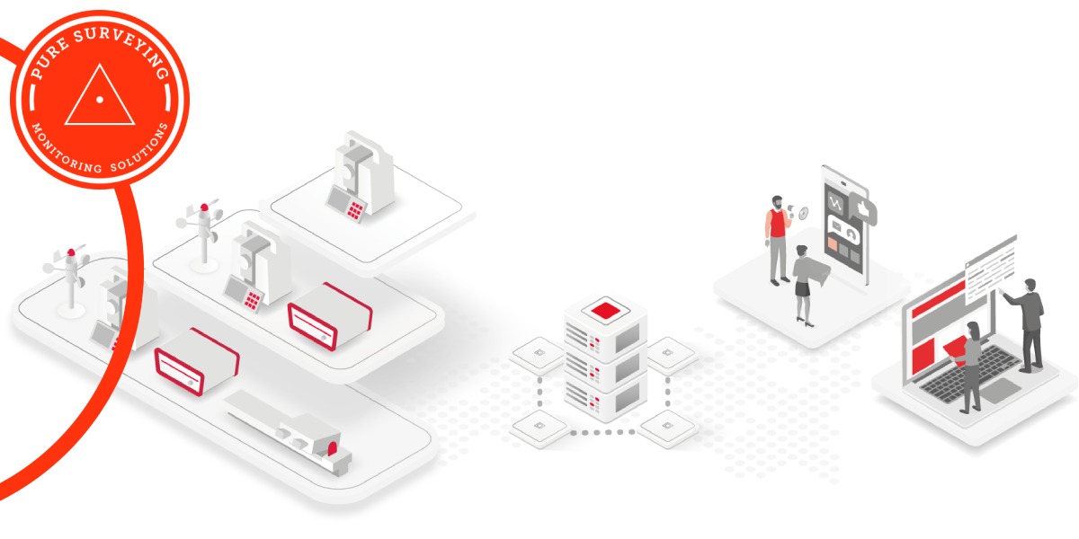
In the planning phase of a project, monitoring aids in the preliminary analysis and testing of a site. This helps to determine the suitability and stability of the ground covered by the project and its surrounding areas before any project is carried out.
With constant impact and movements, construction poses many major risks that might affect the health and safety of those working on and around the site. Be it detecting movements within your project or in neighbouring areas, it is important that monitoring is performed throughout the execution phase.
Long-term monitoring ensures the stability of existing structures despite the impact of maintenance and aging as well as the potential impact of nearby construction activity, seismic activity and other natural hazards.
Why deal with Global Survey? What sets us apart is the calibre of our people and our continued investment in our company resources. With a team of highly skilled experts, our Geomatics team are uniquely positioned to deliver industry-leading service, training and we stand by our commitment of unparalleled support for our customers.
Auckland & North Island

Auckland & North Island
Christchurch & South Island
.png?width=300&height=300&name=Stu%20Circle%20(1).png)
Geomatics Technical Support

Home | Privacy Policy | Contact | Back To Top
![]()
![]()