.jpg)
Kurloo is a brilliantly simple displacement and settlement monitoring technology that autonomously monitors risk and supports better informed decisions.
This cost-effective solution combines reliable all-in-one Kurloo units installed at monitoring points to collect data remotely and the Kurloo Nest cloud-based processing platform for data visualisation and analysis.
The patented Kurloo device and Nest software platform uniquely combine Global Navigation Satellite Systems (GNSS) and the Internet of Things (IoT) to deliver precise and frequent positioning data.
Kurloo is an end-to-end, automated surface displacement monitoring service like no other. It puts millimetre precise positioning at your fingertips to keep a watchful eye on displacement impacts on structures and surfaces.
Kurloo detects movement in buildings, built structures and ground surfaces. Combining state-of-the-art technology, Kurloo helps you manage risk more easily and economically than ever before by providing reliable autonomous data with valuable context to make better decisions faster.
Daily Measurements with relative accuracy of 3-5mm XYZ..
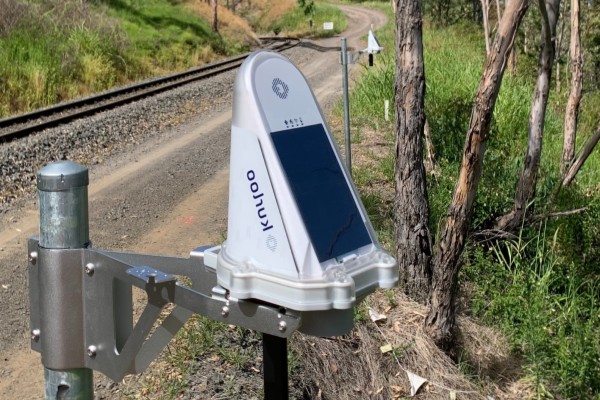
Combining advanced Global Navigation Satellite System (GNSS), the Internet of Things (IoT) and cloud computing technology, Kurloo technology delivers mm precise and accurate insights to help you manage risk.
Autonomous monitoring
Once installed, Kurloo does the rest. Daily readings are taken at predetermined intervals and updates are managed remotely. Kurloo is therefore ideal for difficult-to-access, risky or restricted environments.
Point- specific accuracy
Greater frequency, consistency and precision of readings than traditional monitoring. With a clear view of the sky, Kurloo will deliver measurements within 3mm in X, Y & Z.
Detailed insights
With its on-board GNSS components and environmental sensors, each Kurloo device detects variable movement and disturbance within its environment. Customise alerts to know precisely when change has occurred.
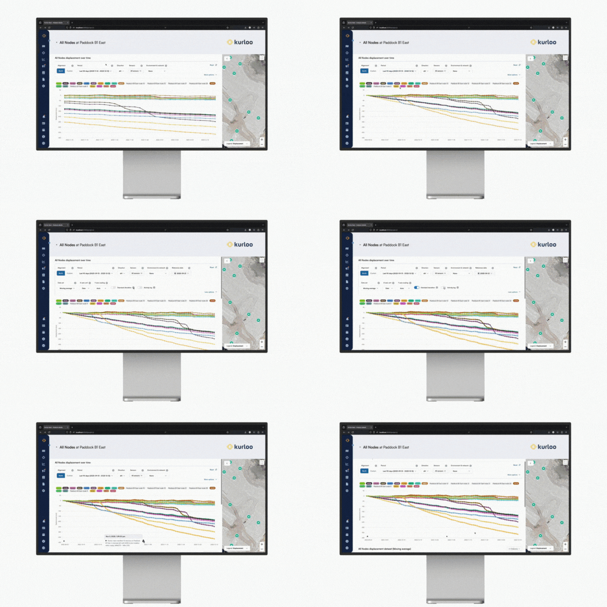
It’s in the Kurloo Nest, our advanced cloud processing platform, that the real magic happens. Once the device readings have all taken place, your data flocks back to the Kurloo Nest for post-processing in near-real time.
Precise data
Easy to navigate and simple to use, the Kurloo Nest allows you to view, manage, adapt and export data – securely and on-demand. Any device, any time.
Kurloo Nest Sync
Easily synchronize your installation records to the Kurloo Nest to automatically start the backend initialisation process for the installed devices.
Secure & Private
Your data’s security is our top priority. Your Kurloo Nest account ensures that your project information is secure and only authorised users are able to access any data.
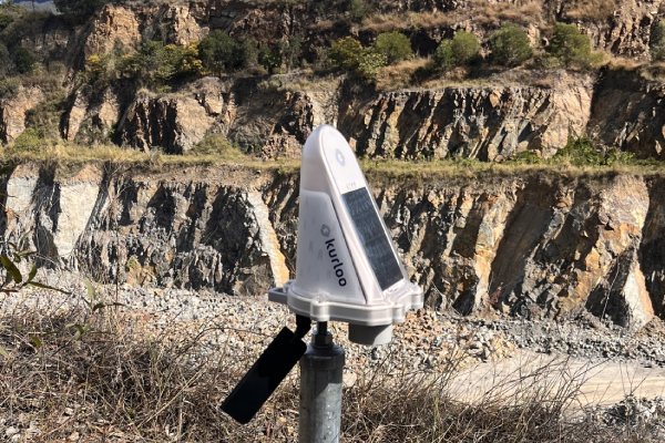
Kurloo is making monitoring more accessible and more affordable with a Hardware as a Service (HaaS) pricing model that delivers an all-in-one remote monitoring solution for a fixed, low cost daily rate.
Contact our team for a no obligation demo of the Kurloo remote monitoring solution and see for yourself the real potential of this solution.
We can take you through full data sets to see the powerful insights this solution delivers.
Simple to install, Kurloo works autonomously and remotely to eliminate the need for frequent site visits.
Kurloo Nest enables online analysis with frequent readings at a rate of your choosing with near real-time results.

Kurloo monitoring technology was invented and is made in Australia by geospatial experts. Global Survey have been named as the exclusive distribution partner for Kurloo in New Zealand.
“Kurloo is a brilliantly simple monitoring technology that leverages the power of GNSS to make autonomous and remote monitoring more widely accessible. Our team are excited about being able to offer Kurloo to our customers to enable data driven decision making on critical projects across New Zealand”. – Bruce Robinson, Director - Global Survey.
Watch how Kurloo technology is being used by Ports of Brisbane for ongoing settlement plate monitoring. Kurloo’s IoT GNSS sensors were installed at strategic locations and have captured data on a high-frequency basis.
The real-time data, captured for over a year, enables the Project Engineers to make informed decisions around ground conditions and future property developments.
See how Queensland Rail Engineers used Kurloo technology to help monitor land movement after significant rainfall in 2023.
The data collected is analysed remotely and used to make critical decisions on the Toowoomba Slope Stabilisation Project, with the objective of ensuring the safety and reliability of the rail network.
Why deal with Global Survey? What sets us apart is the calibre of our people and our continued investment in our company resources. With a team of highly skilled experts, our team are uniquely positioned to deliver industry-leading service, training and we stand by our commitment of unparalleled support for our customers.
Auckland & North Island

Auckland & North Island

Christchurch & South Island
.png?width=300&height=300&name=Stu%20Circle%20(1).png)
Geomatics Technical Support

Home | Privacy Policy | Contact | Back To Top
![]()
![]()